National Monument · NPS · NM
Petroglyph National Monument
Photo: NPS Photo / Daniel Leifheit, Handprint petroglyphs in Piedras Marcadas Canyon
Alerts and conditions
Caution Be City Smart: Take precautions to secure your vehicle and valuables.
This is an urban park. Don't hide valuables inside your car. Carry items with you on hike. Lock your vehicle and set car alarm. Report suspicious persons loitering/peeking in cars. Call 928-638-7805
Information Attention Visitors, Cab drivers, Uber drivers, and transportation service drivers
DO NOT drop off your passengers at the visitor center. No trail access. Visitors must be driven to a trail system from the visitor center. If passengers want to go to the visitor center, WAIT FOR THEM in the parking lot until they come back out.
Information Bicycle Use In The Monument
Bicycles are ONLY allowed at the following locations: 1 - On the Boca Negra Canyon paved multiuse path; bicycles must remain on the paved bike path. 2 - On the crusher fine trail that winds in and out of the park around the mesa top above Boca Negra.
Overview
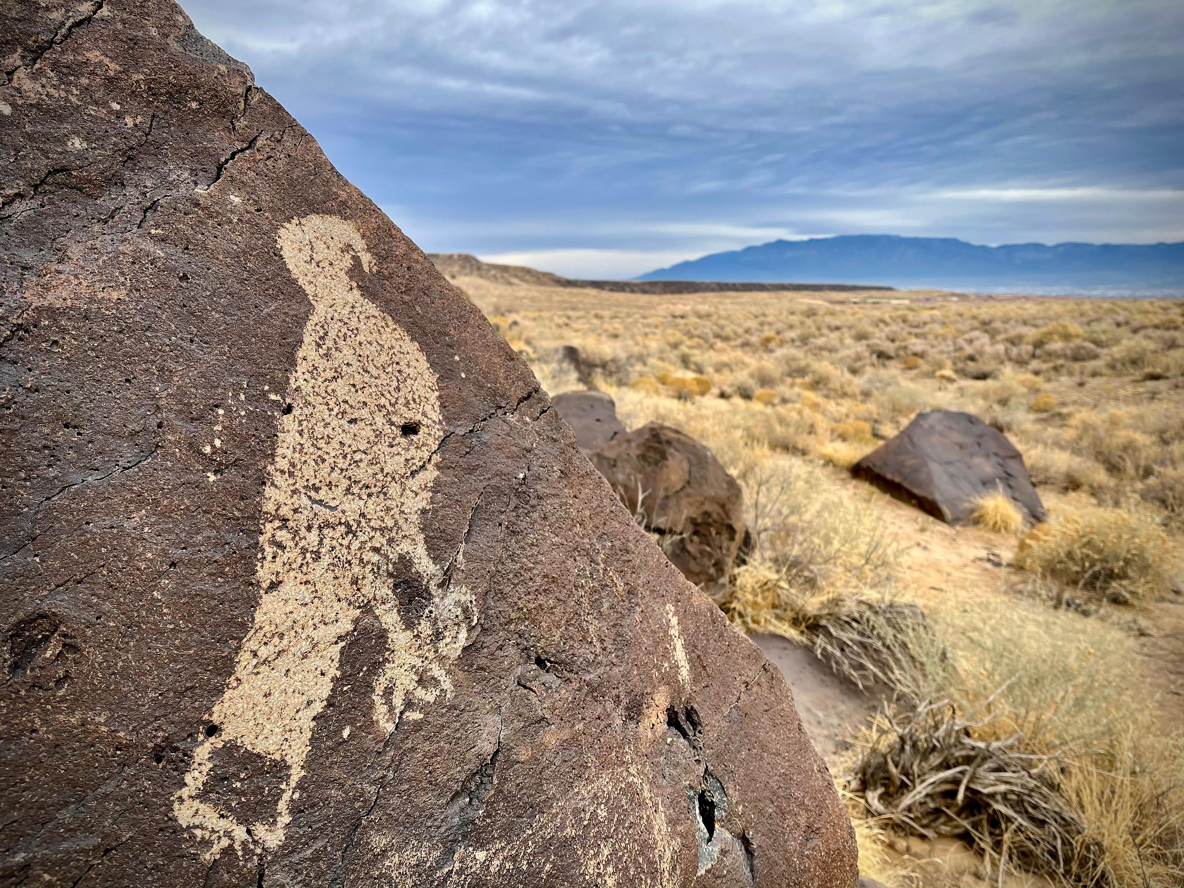
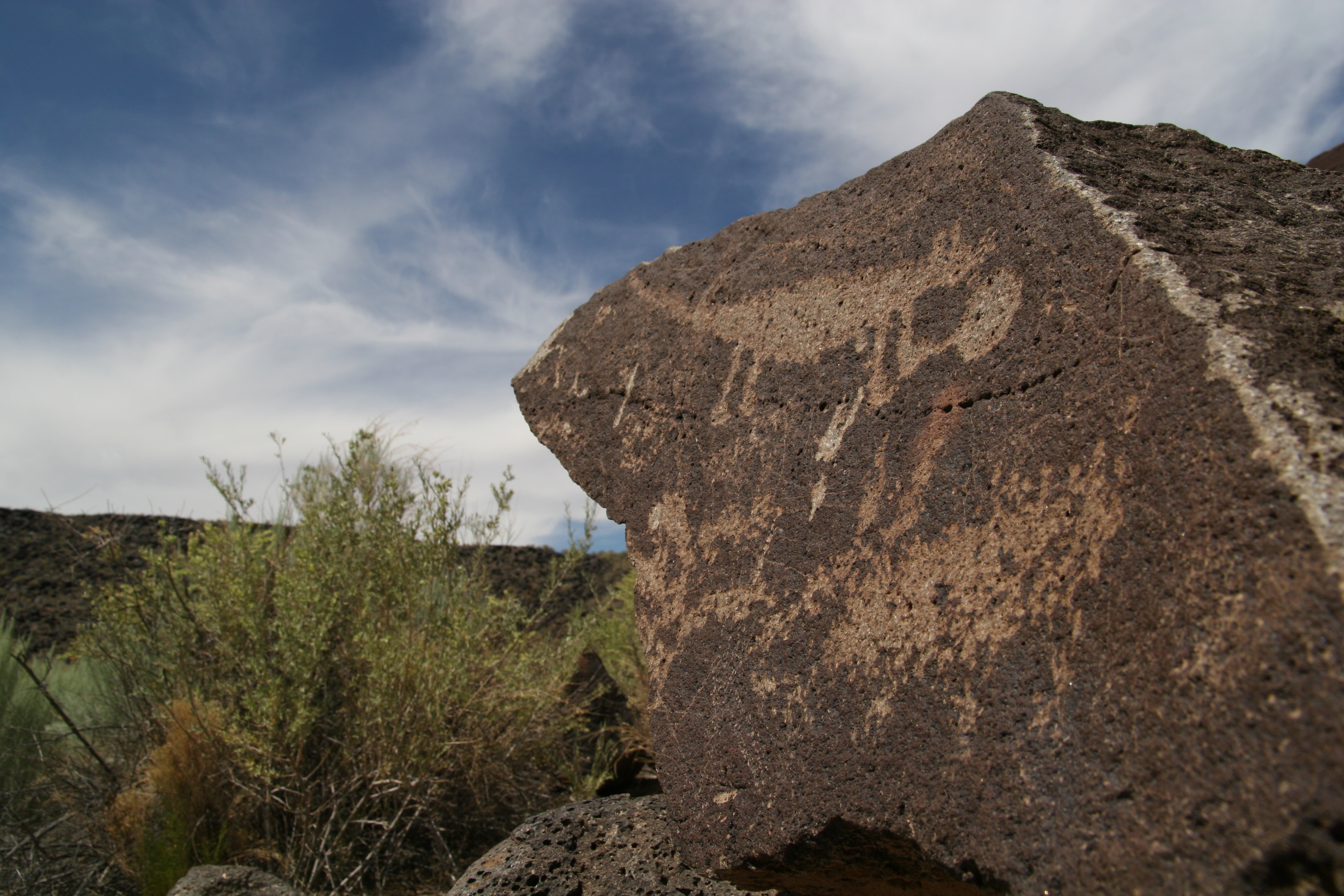
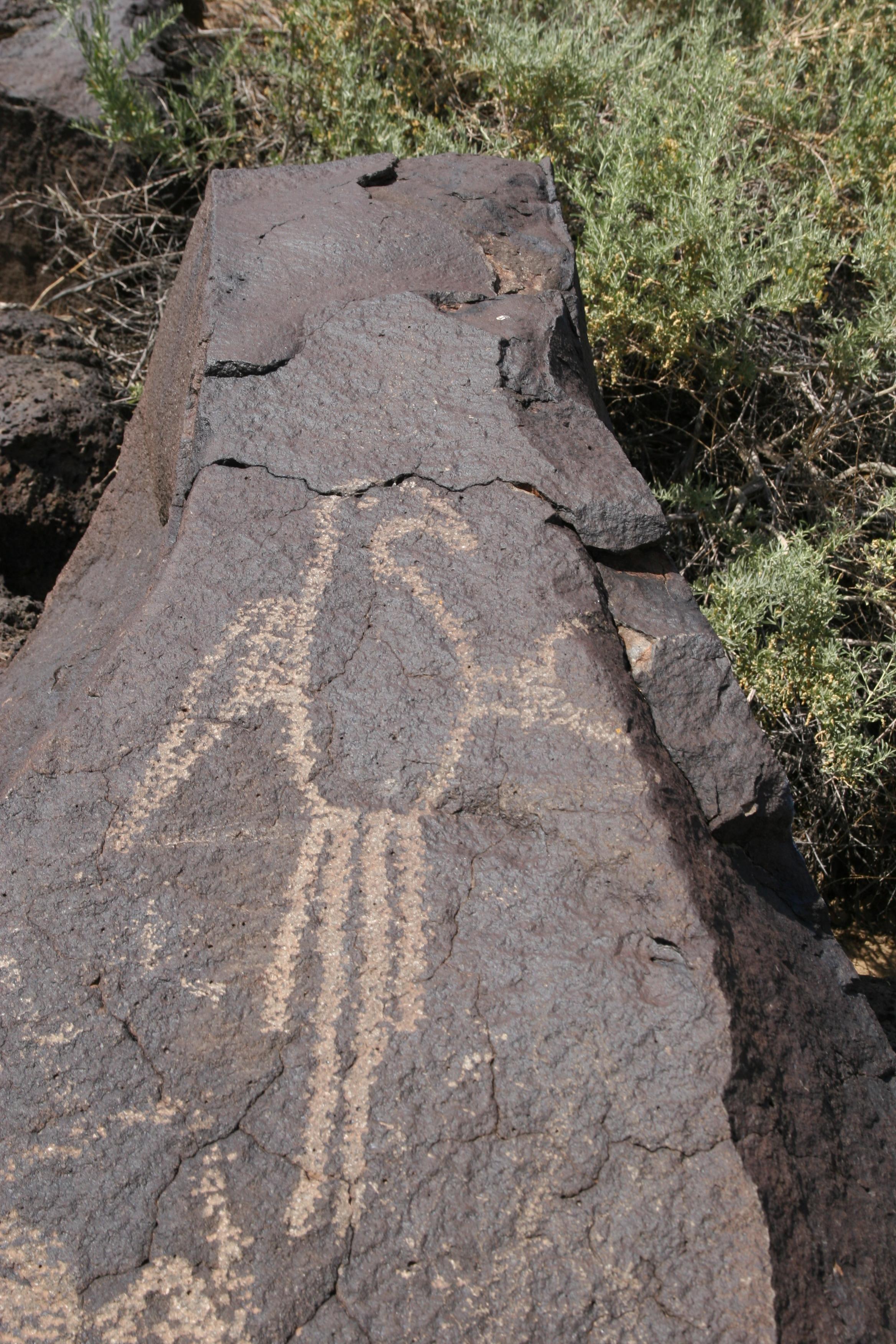
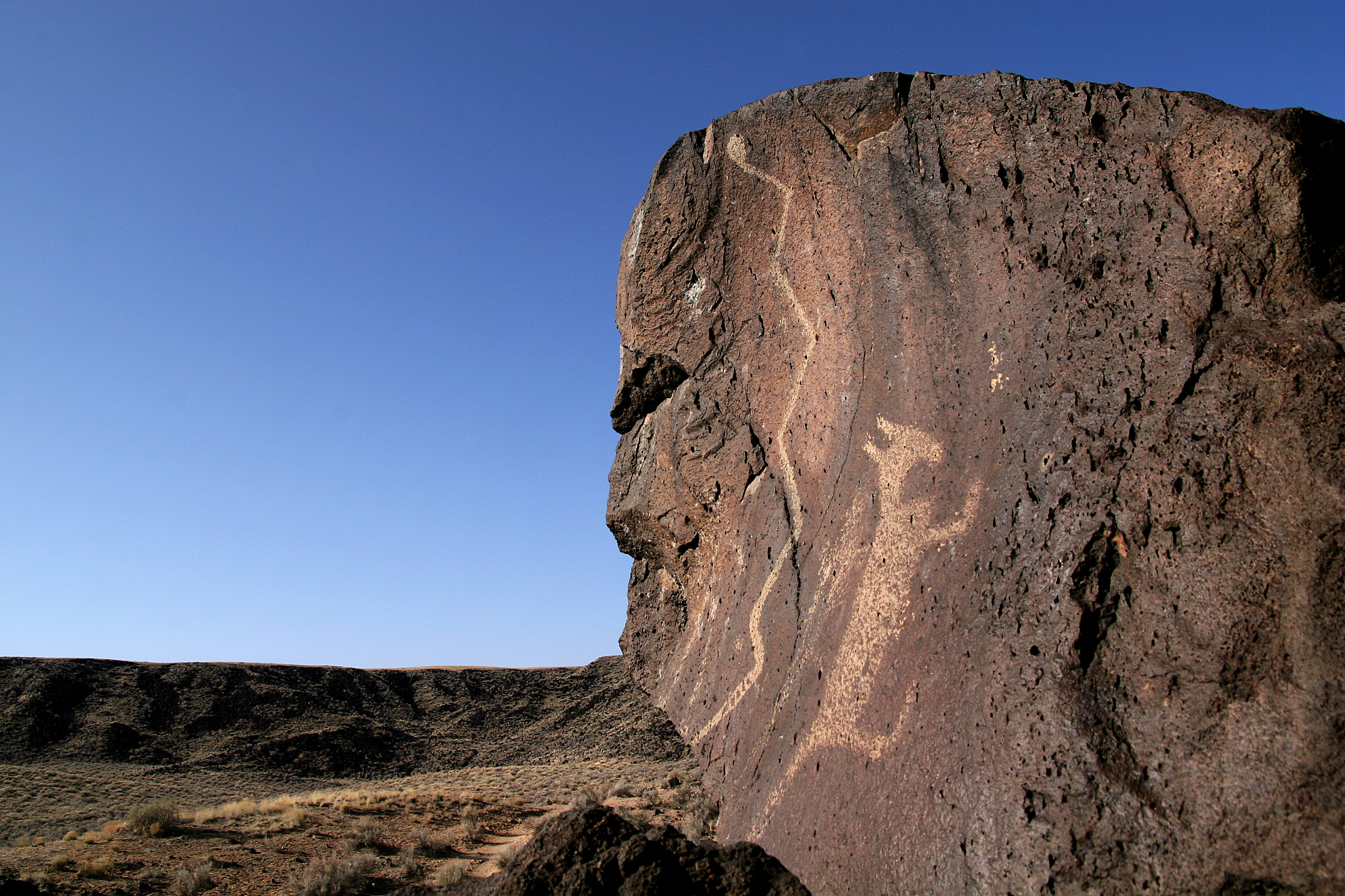
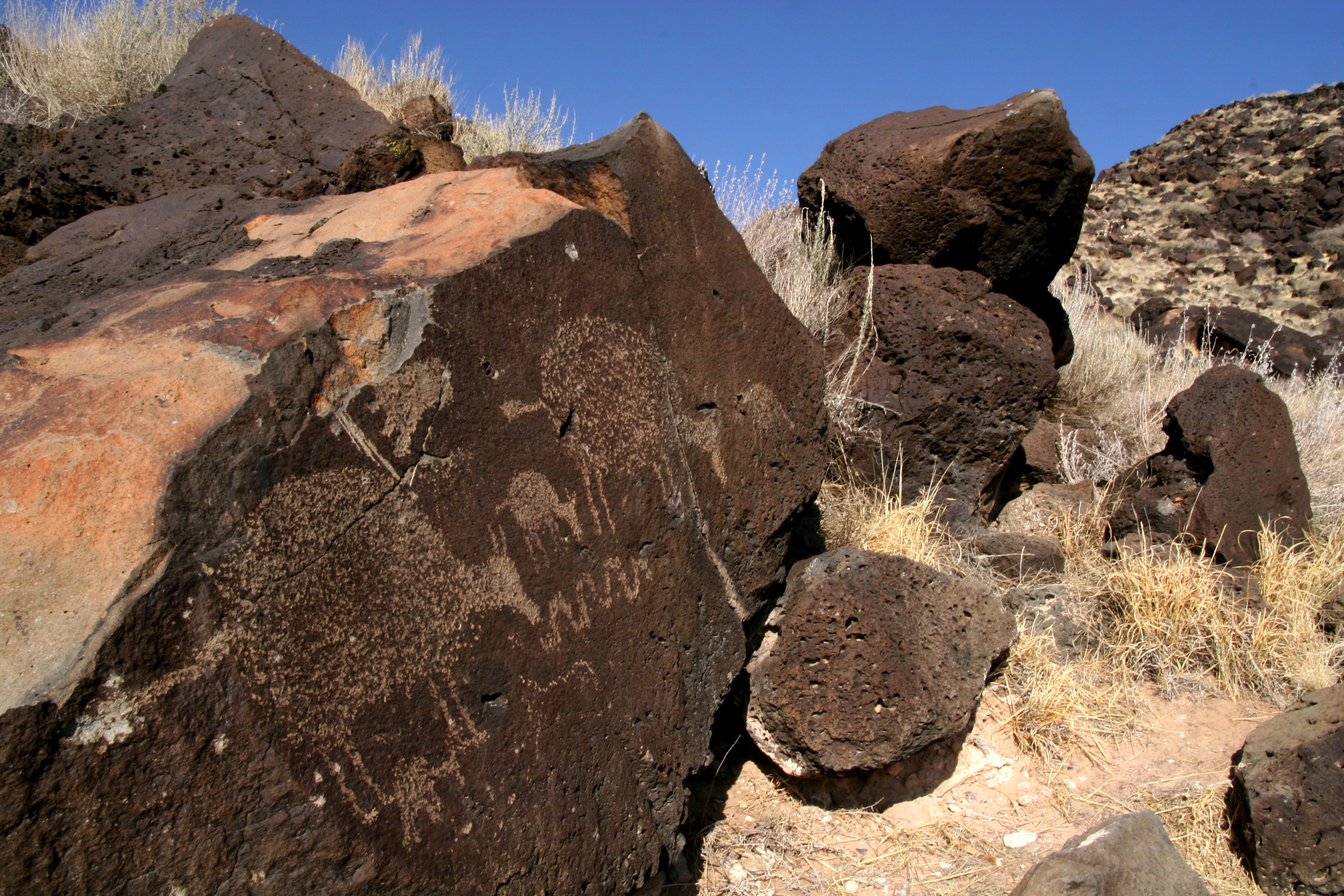
Petroglyph National Monument protects one of the largest petroglyph sites in North America, featuring designs and symbols carved onto volcanic rocks by Native Americans and Spanish settlers 400 to 700 years ago. These images are a valuable record of cultural expression and hold profound spiritual significance for contemporary Native Americans and for the descendants of the early Spanish settlers.
From the National Park Service
History
The designation history for this site (every law, proclamation and order, and the administration behind each) is being researched and checked by the Library’s historians.
What to see and do
Activities
- Hiking
- Front-Country Hiking
- Junior Ranger Program
- Wildlife Watching
- Birdwatching
- Park Film
- Shopping
- Bookstore and Park Store
Plan your visit
Hours
Boca Negra Canyon: Staffed by our partner, the City of Albuquerque Open Space, this developed trail system consists of 3 short, paved trails with trail markers. Full-service restroom facility, picnic tables, shaded seating areas and a shaded patio area. See up to 100 petroglyphs in one hour if you walk all 3 trails. Last entry is at 4:00 pm daily and all visitors are swept out at 4:30 pm sharp. Pets not allowed on the petroglyph viewing trails. Trails are not accessible for wheelchairs or strollers.
Rinconada Canyon: Water is not available. A 2.2-mile round trip trail where up to 300 petroglyphs can be viewed, especially in the back of the canyon. The natural earth surface trail is easy to moderate to walk. Picnic tables are located in the parking lot. A vault toilet is available. Open for hiking on holidays. Parking lot hours: 8 am to 5 pm daily. Access: Sunrise to sunset by parking in outer lot (3 spaces). Lock your vehicle, secure your valuables, do not leave any items visible. Leashed pets okay, must pick up poop.
Piedras Marcadas Canyon: Nestled in the northernmost tip of the monument, this undeveloped trail system is a 6.5-mile drive from the information center. The petroglyph viewing trail is 1.5 miles in and out. No water, no restroom, no amenities available. See up to 400 petroglyphs. Leashed pets allowed, pick-up waste & put in trash can. The non-gated parking lot is located off Golf Course Rd. at Jill Patricia St. (behind the Valvoline Motor Oil station, use Google maps). Stop by the information center for a free trail guide.
Volcanoes Day Use Area: No petroglyph viewing available. Parking lot hours: 9 am to 5 pm daily. Access: Sunrise to sunset. 1 to 4 miles of hiking trails lead you to the scenic overlook or around the bases of the cinder cones. Hiking to the tops of cones is prohibited. No water available. Vault restroom, benches, and trash cans available. Leashed pets allowed. Owners must pick-up waste & place in trash can. Parking lot is located off Atrisco Vista Blvd. (exit #149) about 4.7 miles north of I-40. Pick up a trail map at Info Center.
Getting there
GPS: Lat: 35.139 Long: -106.711 From Interstate 40, take the Unser Blvd. exit (#154) proceed north 3 miles to Western Trail. Turn left or west onto Western Trail and follow road to the Information Center parking lot. From Interstate 25, take the Paseo del Norte exit (#232) and proceed west to Coors Road exit south (must be in center lane to veer left at the Y). Proceed south on Coors Road to Western Trail. Turn right or west onto Western Trail and follow road to the Information Center parking lot.
Visitor centers
- Petroglyph Information Center
Weather
Altitude approx. 5000 ft. Usually sunny and dry, with low relative humidity. Winter temperatures range from 40 to 50 degrees F. Summer temperatures range from 88-99 degrees F. 278 days of sunshine per year. Spring can be windy with 20 to 30 mph sustained winds which can produce periods of blowing sand and dust. For current weather forecast, Google Albuquerque weather.
Phone: 5058990205
Whose lands these are
These lands are the ancestral and present-day homelands of Native nations. A section on whose lands these are is being prepared with tribal review. In the meantime, Native Land Digital offers a starting point.
Photos
Pair it with
- Valle de Oro National Wildlife Refuge FWS · 12 miles
- Kasha-Katuwe Tent Rocks National Monument BLM · 40 miles
- Jemez National Recreation Area USFS · 46 miles
- Bandelier National Monument NPS · 50 miles
- Valles Caldera National Preserve NPS · 55 miles
- Sevilleta National Wildlife Refuge FWS · 57 miles