National Monument · NPS · CA · Roosevelt connection
Muir Woods National Monument
Photo: NPS/ Jace Ritchey, Rays of Light at Muir Woods
Alerts and conditions
Caution Auto-Theft Warning - Only Bring What You Need to the Park
You can prevent vehicle break-ins in parking lots and scenic overlooks. Before leaving your car for even a short period of time: 1) Remove all valuables, 2) Lock your doors. 3) Take your wallets, purses, backpacks, keys, key fobs, cell phones, and electronics with you. Read article for more details.
Information Parking Reservations Always Required
Reservations are required for all personal vehicles and shuttle riders visiting Muir Woods. You can make your reservation by visiting www.gomuirwoods.com. Visit our "Know Before You Go" webpage to learn more important details before your visit.
Information No Cell Service at Muir Woods
There is NO cell service at Muir Woods. We discourage scheduling a rideshare service to leave the park. When hiring a taxi, visitors have the option of negotiating a flat rate or using the meter. Under some circumstances a flat rate may be cheaper.
Information Mount Tamalpais State Park - Trail Conditions
Many trails in Muir Woods connect to trails in Mount Tamalpais State Park. For up-to-date information about trail conditions within State Park boundaries, check the Mount Tamalpais State Park Info page (click more) and scroll down to Trail Updates.
Weather Coastal Flood Advisory issued November 8 at 12:05PM PST until November 10 at 12:00PM PST by NWS San Francisco CA
* WHAT...For the Coastal Flood Advisory, up to 1.6 ft of
inundation above ground level is possible in low-lying areas
near shorelines and tidal waterways. For the Beach Hazards
Statement, an increased risk for sneaker waves and strong rip
currents with breaking waves of 12 to 16 ft expected.
* WHERE...Pacific Coast.
* WHEN...For the Beach Hazards Statement through Monday evening.
For the Coastal Flood Advisory, through noon PST Tuesday.
* IMPACTS...Waves can sweep across the shoreline without
warning, pulling people into the sea from beaches, jetties,
and rocks.
* ADDITIONAL DETAILS...At the San Francisco tide gauge, high tide
is expected to be: 1.5 ft above normal (7.3 ft MLLW) at 10:35
AM Monday 11/9, 1.5 ft above normal (7.3 ft MLLW) at 11:04 AM
Tuesday 11/10. These predictions include up to 1.2 ft of surge
that will enhance the astronomical tide and flooding threat.
High tide varies up to 90 minutes earlier or later along the
Pacific Coast and through the San Francisco Bay, respectively.
What to do: If travel is required, allow extra time as some roads may be closed. Do not drive around barricades or through water of unknown depth. Take the necessary actions to protect flood-prone property. Stay off of jetties, piers, rocks, and other waterside infrastructure. Remain out of the water to avoid hazardous surf and NEVER turn your back on the ocean. Monitor local weather, surf and tide forecasts at www.weather.gov/mtr.
Read the full alert · Until Nov 10, 2026, 8:00 PM
Weather Beach Hazards Statement issued November 8 at 12:05PM PST until November 9 at 10:00PM PST by NWS San Francisco CA
* WHAT...For the Coastal Flood Advisory, up to 1.6 ft of
inundation above ground level is possible in low-lying areas
near shorelines and tidal waterways. For the Beach Hazards
Statement, an increased risk for sneaker waves and strong rip
currents with breaking waves of 12 to 16 ft expected.
* WHERE...Pacific Coast.
* WHEN...For the Beach Hazards Statement through Monday evening.
For the Coastal Flood Advisory, through noon PST Tuesday.
* IMPACTS...Waves can sweep across the shoreline without
warning, pulling people into the sea from beaches, jetties,
and rocks.
* ADDITIONAL DETAILS...At the San Francisco tide gauge, high tide
is expected to be: 1.5 ft above normal (7.3 ft MLLW) at 10:35
AM Monday 11/9, 1.5 ft above normal (7.3 ft MLLW) at 11:04 AM
Tuesday 11/10. These predictions include up to 1.2 ft of surge
that will enhance the astronomical tide and flooding threat.
High tide varies up to 90 minutes earlier or later along the
Pacific Coast and through the San Francisco Bay, respectively.
What to do: If travel is required, allow extra time as some roads may be closed. Do not drive around barricades or through water of unknown depth. Take the necessary actions to protect flood-prone property. Stay off of jetties, piers, rocks, and other waterside infrastructure. Remain out of the water to avoid hazardous surf and NEVER turn your back on the ocean. Monitor local weather, surf and tide forecasts at www.weather.gov/mtr.
Read the full alert · Until Nov 10, 2026, 6:00 AM
Overview
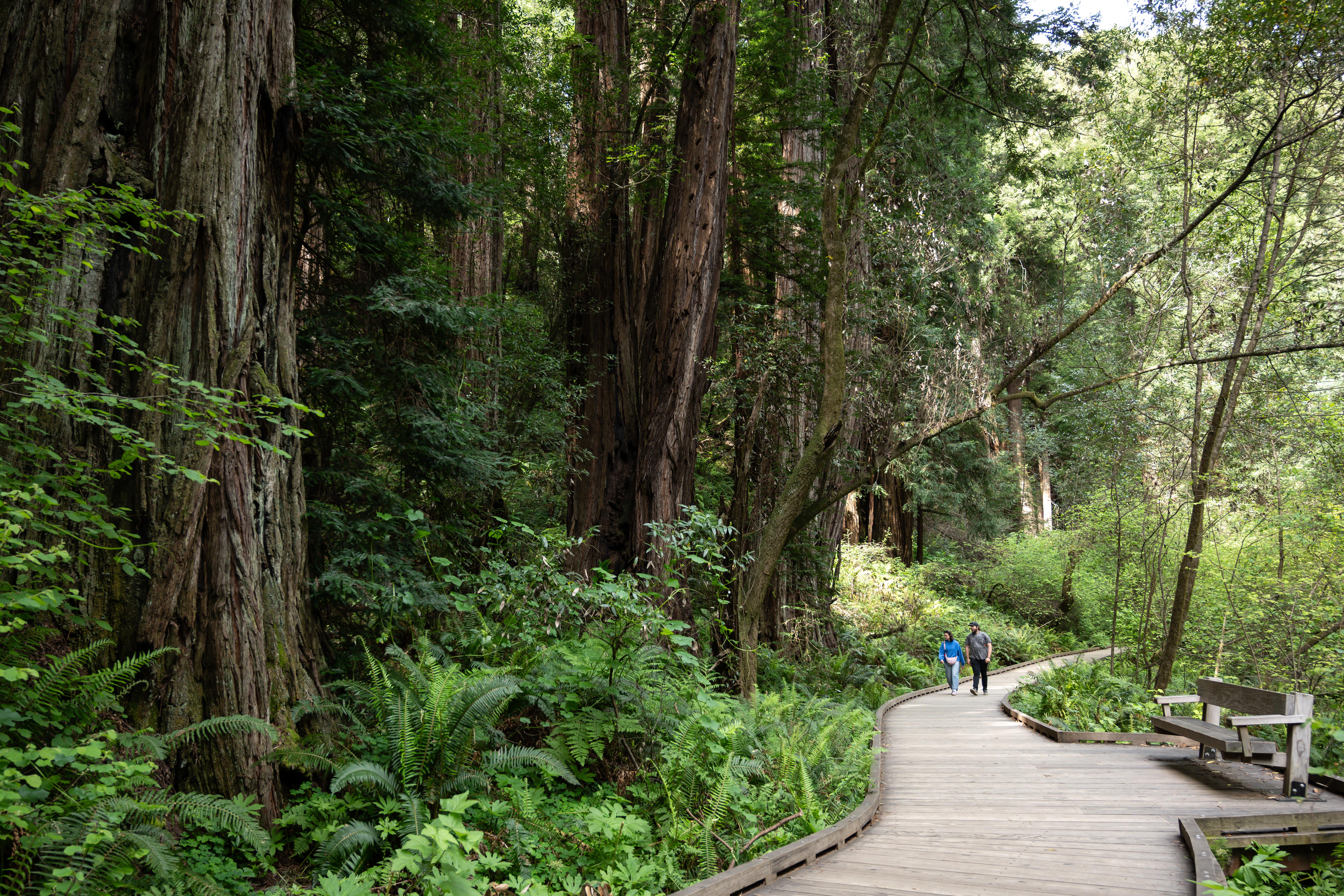
Walk among old growth coast redwoods, cooling their roots in the fresh water of Redwood Creek and lifting their crowns to reach the sun and fog. Federally protected as a National Monument since 1908, this primeval forest is both refuge and laboratory, revealing our relationship with the living landscape. What will you discover in Muir Woods?
From the National Park Service
History
The designation history for this site (every law, proclamation and order, and the administration behind each) is being researched and checked by the Library’s historians.
The Roosevelt connection
Protected by T.R.
- January 9, 1908: as President, Theodore Roosevelt set aside Muir Woods National Monument. Old-growth coast redwoods given to the nation by William and Elizabeth Thacher Kent, the first monument created on donated land. It was named for John Muir.
presidency.ucsb.edu · web.archive.org · nps.gov · Roosevelt’s Public Lands
His proclamations and orders
- January 9, 1908: Proclamation 793, “Setting Aside Muir Woods National Monument, California.” Today’s site began with this document. The only old-growth coast redwood forest in the San Francisco Bay Area.
Proclamation 793 in Theodore Roosevelt’s Executive Orders and Proclamations
What to see and do
Activities
- Food
- Dining
- Guided Tours
- Hiking
- Junior Ranger Program
- Wildlife Watching
- Birdwatching
- Shopping
- Bookstore and Park Store
Plan your visit
Hours
Muir Woods National Monument: Muir Woods is open every day of the year, with exceptions for inclement weather and hazardous conditions. Our core winter hours are 8 am- 5 pm; in the spring, summer, and fall we are open later based on increased daylight hours. Updates on closures will be posted as an alert to the website and on social-media pages.
Fees and passes
- Entrance - Per Person — $15.00
- Annual Entrance - Park — $45.00
The America the Beautiful pass covers entrance fees at federal recreation lands across all four agencies.
Getting there
From San Francisco: Muir Woods is located 11 miles north of the Golden Gate Bridge. Take Hwy 101 North --> Mill Valley/Highway 1/ Stinson Beach Exit --> Follow the signs to Hwy 1 --> Follow the signs to Muir Woods From the north: Take Hwy 580/Richmond/San Rafael Bridge West --> Hwy 101 South --> Take the Stinson Beach/Mill Valley Exit --> Follow the signs to Highway 1 --> Follow the signs to Muir Woods No vehicles over 35 feet. Vehicles over 17ft need an oversized parking spot. More info below:
Visitor centers
Weather
The coast redwood forest is cool most times of the year with temperatures ranging from 40 - 70 F/ 4 - 21 C. Always come prepared with layers. From late October to early May, expect cool weather & possible rain. Summer months (June-August) can be warmer, but it is generally cool and dry. Expect heavy fog in the morning, burning off in the afternoon. Often, the fall (September-October) is the warmest time of year.
Phone: 415-561-2850
Whose lands these are
These lands are the ancestral and present-day homelands of Native nations. A section on whose lands these are is being prepared with tribal review. In the meantime, Native Land Digital offers a starting point.
Photos
Pair it with
- Golden Gate National Recreation Area NPS · 2 miles
- Marin Islands National Wildlife Refuge FWS · 8 miles
- Fort Point National Historic Site NPS · 9 miles
- Presidio of San Francisco NPS · 9 miles
- Alcatraz Island NPS · 10 miles
- San Francisco Maritime National Historical Park NPS · 11 miles