Historic Site and Historical Park · NPS · CA
Fort Point National Historic Site
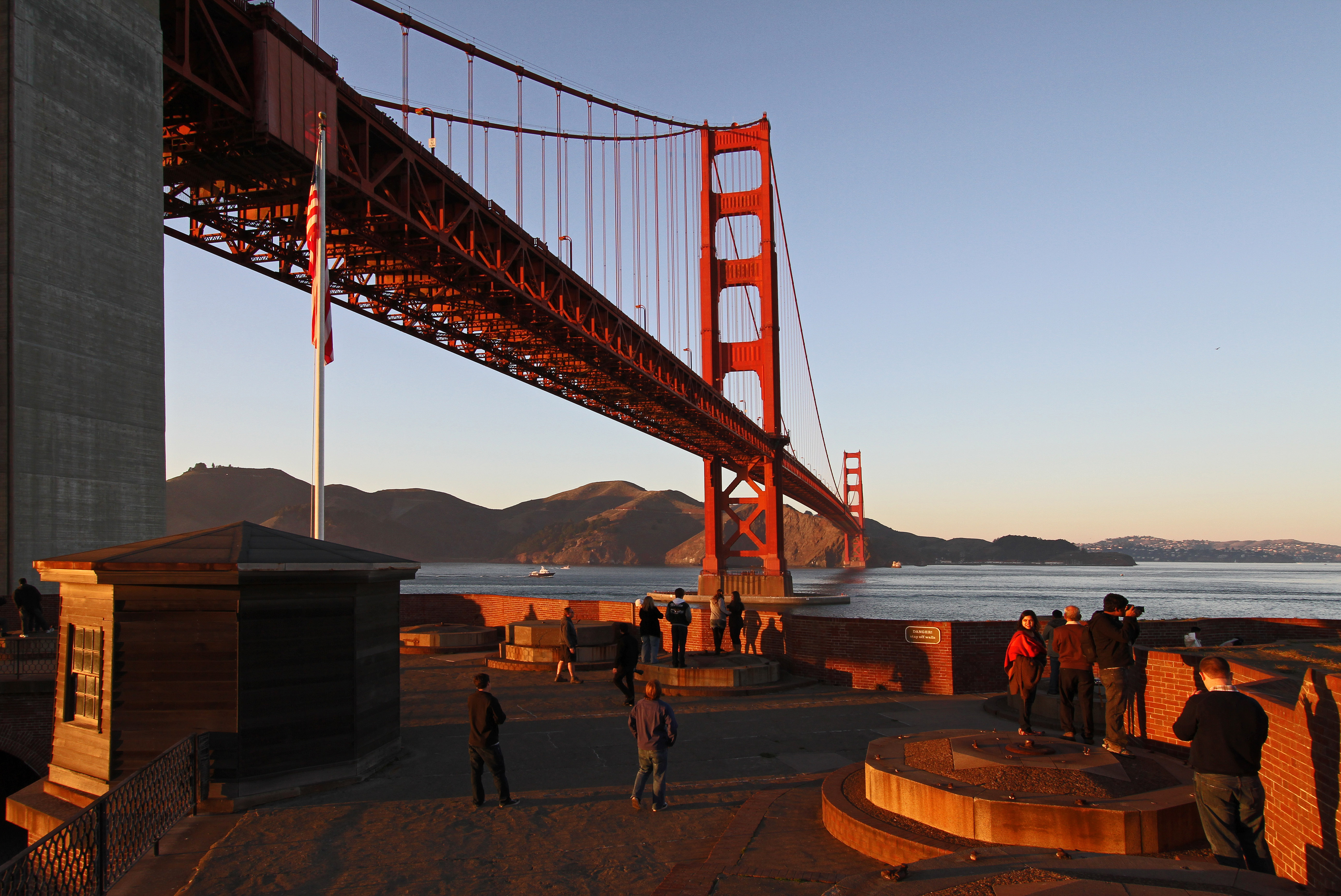
Photo: NPS photo/Will Elder, Fort Point from Marine Drive
Alerts and conditions
Caution Beach Hazards In Effect November 5-9
Thursday, November 5, 5:00 AM PST to Monday, November 9, 10:00 PM PST Increased risk for sneaker waves and strong rip currents with breaking waves of 12 to 16 ft expected. Waves can sweep across the shoreline without warning, pulling people into the sea from beaches, jetties, and rocks. Stay off jetties, rocks, and remain out of the water to avoid hazardous surf and NEVER turn your back on the ocean. See link below for more beach safety info.
Caution Auto-Theft Warning - Only Bring What You Need to the Park
You can prevent vehicle break-ins in parking lots and scenic overlooks. Before leaving your car for even a short period of time: 1) Remove all valuables, 2) Lock your doors. 3) Take your wallets, purses, backpacks, keys, key fobs, cell phones, and electronics with you. Read article for more details.
Weather Beach Hazards Statement issued November 8 at 12:05PM PST until November 9 at 10:00PM PST by NWS San Francisco CA
* WHAT...For the Coastal Flood Advisory, up to 1.6 ft of
inundation above ground level is possible in low-lying areas
near shorelines and tidal waterways. For the Beach Hazards
Statement, an increased risk for sneaker waves and strong rip
currents with breaking waves of 12 to 16 ft expected.
* WHERE...San Francisco.
* WHEN...For the Coastal Flood Advisory, until 4 PM PST Friday.
For the Beach Hazards Statement, until Monday evening.
* IMPACTS...High tides will result in flooding of low-lying
infrastructure, isolated road closures, and coastal erosion.
Rising tides will bring water and waves farther up the beach
than normal, restricting escape from beaches and coastal
areas. Waves can sweep across the shoreline without warning,
pulling people into the sea from beaches, jetties, and rocks.
* ADDITIONAL DETAILS...At the San Francisco tide gauge, high tide
is expected to be: 1.5 ft above normal (7.3 ft MLLW) at 10:35
AM Monday 11/9, 1.5 ft above normal (7.3 ft MLLW) at 11:04 AM
Tuesday 11/10, 1.4 ft above normal (7.2 ft MLLW) at 11:35 AM
Wednesday 11/11, 1.3 ft above normal (7.1 ft MLLW) at 12:10 PM
Thursday 11/12, 1.1 ft above normal (6.9 ft MLLW) at 12:49 PM
Friday 11/13. These p
What to do: If travel is required, allow extra time as some roads may be closed. Do not drive around barricades or through water of unknown depth. Take the necessary actions to protect flood-prone property. Stay off of jetties, piers, rocks, and other waterside infrastructure. Remain out of the water to avoid hazardous surf and NEVER turn your back on the ocean. Monitor local weather, surf and tide forecasts at www.weather.gov/mtr.
Read the full alert · Until Nov 10, 2026, 6:00 AM
Weather Coastal Flood Advisory issued November 8 at 12:05PM PST until November 13 at 4:00PM PST by NWS San Francisco CA
* WHAT...For the Coastal Flood Advisory, up to 1.6 ft of
inundation above ground level is possible in low-lying areas
near shorelines and tidal waterways. For the Beach Hazards
Statement, an increased risk for sneaker waves and strong rip
currents with breaking waves of 12 to 16 ft expected.
* WHERE...San Francisco.
* WHEN...For the Coastal Flood Advisory, until 4 PM PST Friday.
For the Beach Hazards Statement, until Monday evening.
* IMPACTS...High tides will result in flooding of low-lying
infrastructure, isolated road closures, and coastal erosion.
Rising tides will bring water and waves farther up the beach
than normal, restricting escape from beaches and coastal
areas. Waves can sweep across the shoreline without warning,
pulling people into the sea from beaches, jetties, and rocks.
* ADDITIONAL DETAILS...At the San Francisco tide gauge, high tide
is expected to be: 1.5 ft above normal (7.3 ft MLLW) at 10:35
AM Monday 11/9, 1.5 ft above normal (7.3 ft MLLW) at 11:04 AM
Tuesday 11/10, 1.4 ft above normal (7.2 ft MLLW) at 11:35 AM
Wednesday 11/11, 1.3 ft above normal (7.1 ft MLLW) at 12:10 PM
Thursday 11/12, 1.1 ft above normal (6.9 ft MLLW) at 12:49 PM
Friday 11/13. These p
What to do: If travel is required, allow extra time as some roads may be closed. Do not drive around barricades or through water of unknown depth. Take the necessary actions to protect flood-prone property. Stay off of jetties, piers, rocks, and other waterside infrastructure. Remain out of the water to avoid hazardous surf and NEVER turn your back on the ocean. Monitor local weather, surf and tide forecasts at www.weather.gov/mtr.
Read the full alert · Until Nov 14, 2026, 12:00 AM
Overview
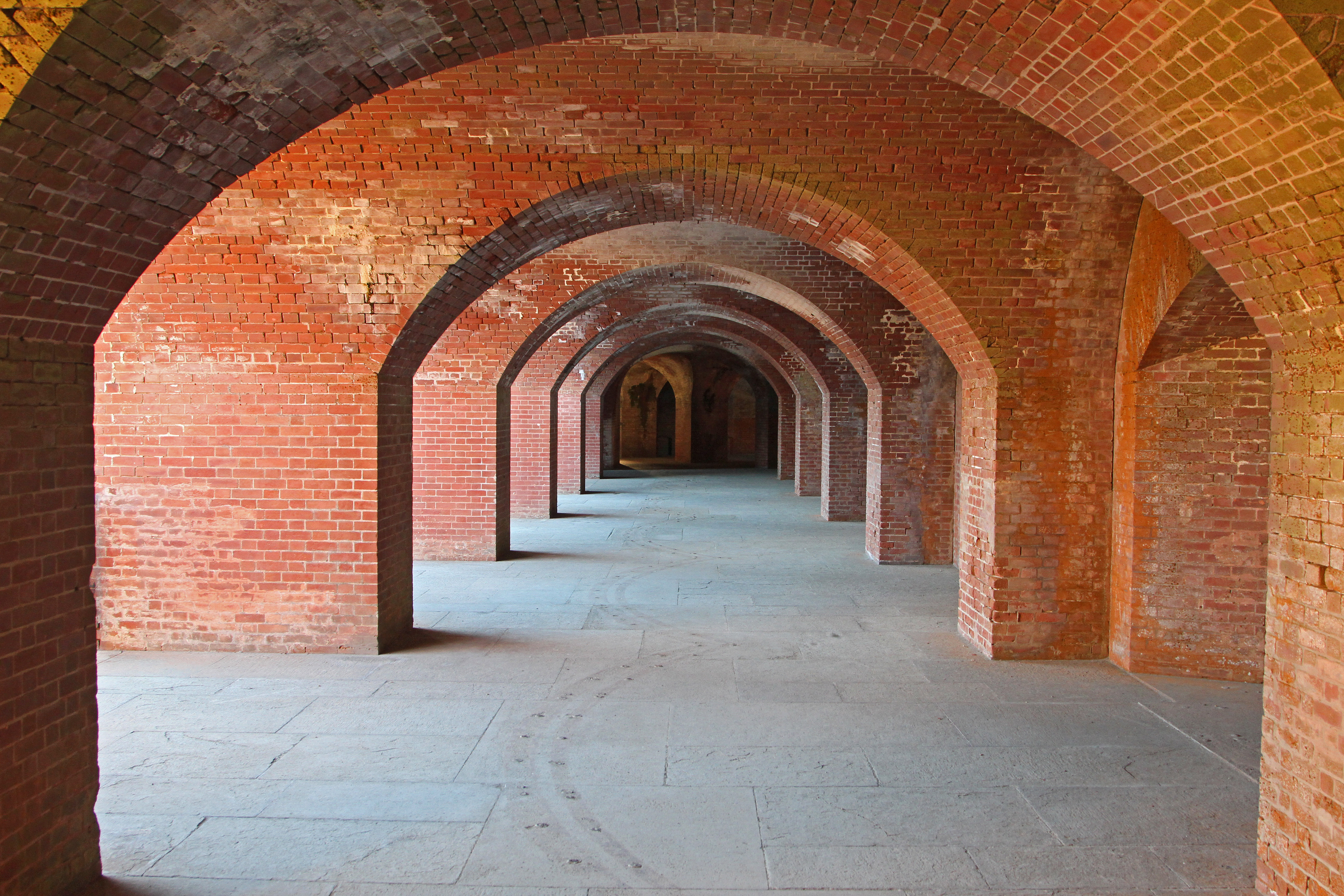
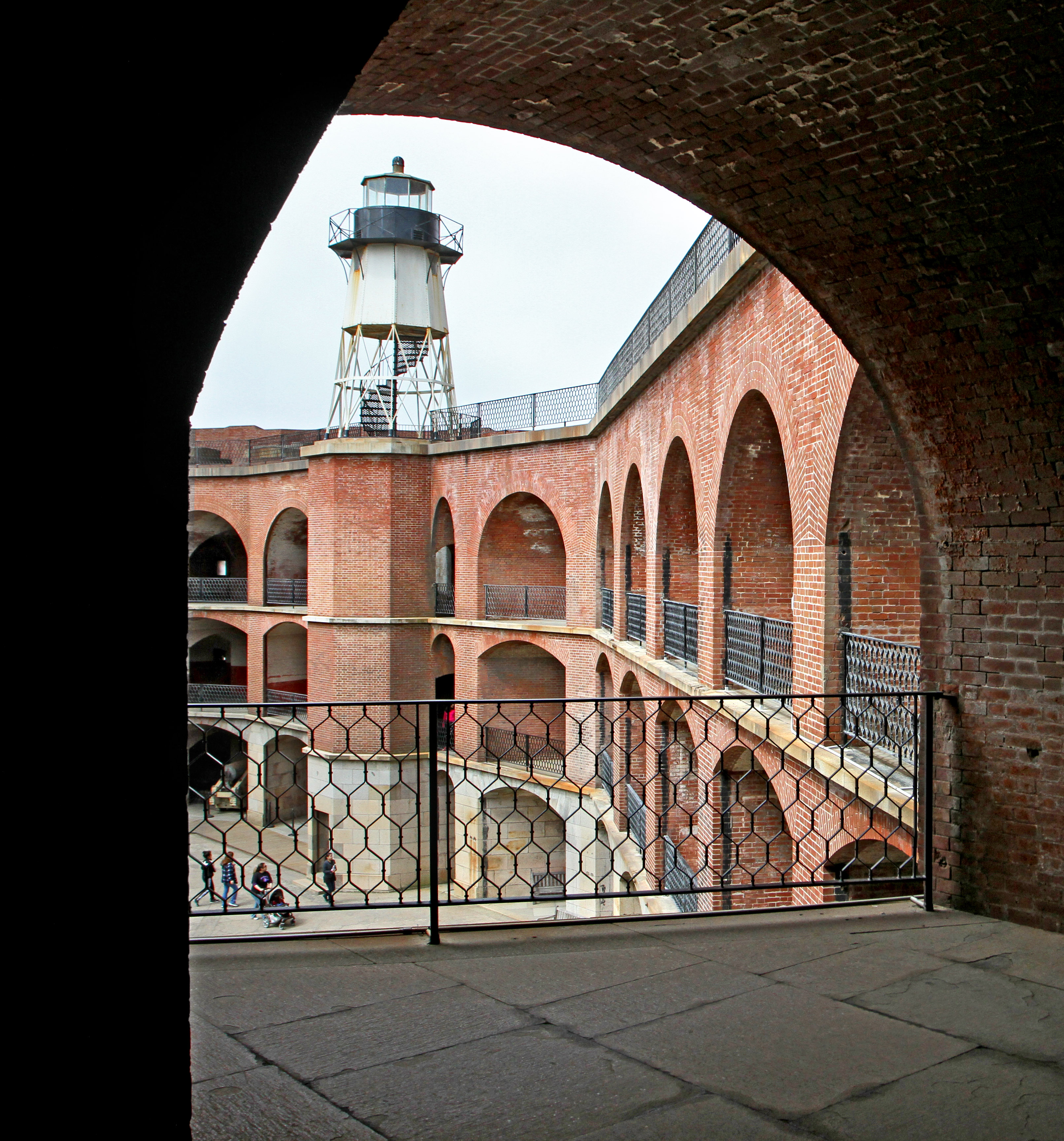
From its vantage point overlooking the spectacular Golden Gate, Fort Point defended the San Francisco Bay following California's Gold Rush through World War II. Its beautifully arched casemates display the art of 3rd system brick masonry and interacts gracefully with the Golden Gate Bridge.
From the National Park Service
History
The designation history for this site (every law, proclamation and order, and the administration behind each) is being researched and checked by the Library’s historians.
What to see and do
Activities
- Arts and Culture
- Theater
- Fishing
- Living History
- Historic Weapons Demonstration
- Park Film
- Museum Exhibits
Plan your visit
Hours
Fort Point National Historic Site: The days in which Fort Point is open varies throughout the year. Fall through Spring the fort is generally open Friday through Sunday. During the summer season the fort is open 5 days a week most years. The timing of the shift in days is not consistent from year to year but generally occurs in October and May. Hours are 10 am to 5 pm. Closed on Thanksgiving, Christmas, and New Year's Day. Visit our web site for current open days.
Getting there
Fort Point is located at the south anchorage of the Golden Gate Bridge at the end of Marine Drive on the Presidio of San Francisco. By car take Highway 101 N or S, exit at the Golden Gate Bridge toll plaza at south end of bridge. From S turn right at end of exit ramp, or from N go straight on Merchant Drive. Turn left onto Lincoln Boulevard. Take a left onto Long Avenue and follow onto Marine Drive.
Visitor centers
Weather
Fort Point is typically cold and windy throughout the year. Fog is especially common in the summer months. Come prepared with layers and windbreakers for maximum comfort.
Phone: 415-561-4323
Whose lands these are
These lands are the ancestral and present-day homelands of Native nations. A section on whose lands these are is being prepared with tribal review. In the meantime, Native Land Digital offers a starting point.
Photos

Pair it with
- Presidio of San Francisco NPS · 1 miles
- San Francisco Maritime National Historical Park NPS · 2 miles
- Alcatraz Island NPS · 3 miles
- Golden Gate National Recreation Area NPS · 8 miles
- Muir Woods National Monument NPS · 9 miles
- Rosie the Riveter WWII Home Front National Historical Park NPS · 9 miles