National Monument · NPS · AZ
Canyon de Chelly National Monument
Photo: Ravis Henry, Canyon Farm
Alerts and conditions
Information Route 7 from Sawmill, AZ is NOT recommended
Entering the park from the east at Sawmill, AZ on Route 7 is not recommended. Part of this route is UNPAVED and UNMAINTAINED. Please stay on paved roads, such as Indian Route 64 from Tsaile, AZ and Highway 191/Route 7 from Chinle, AZ.
Caution Weather Advisory and Storm Warnings
The park may have delayed openings or closures in the event of severe weather. Travel may not be recommended during these times. Please check local weather forecasts. We appreciate your understanding.
Overview
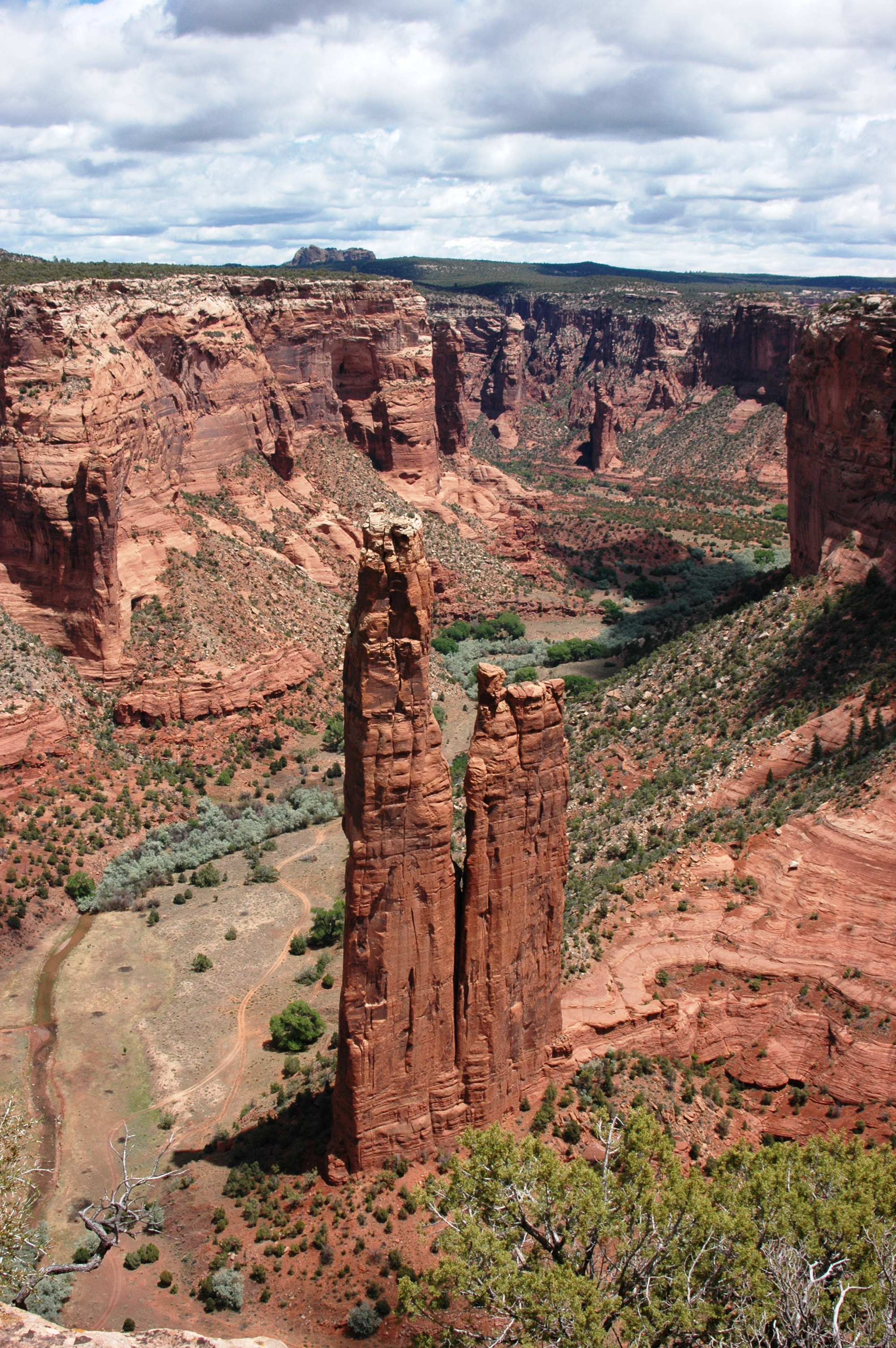
This canyon is home to Diné families who raise livestock, grow crops and live here. People have lived in these canyons for nearly 5,000 years, which is longer than anyone has lived continuously on the Colorado Plateau. In this place called Tsegi, their homes and images tell us their stories. Today, the park and Navajo Nation work together to manage the rich cultural and natural resources.
From the National Park Service
History
The designation history for this site (every law, proclamation and order, and the administration behind each) is being researched and checked by the Library’s historians.
What to see and do
Activities
- Auto and ATV
- Scenic Driving
- Camping
- Guided Tours
- Hiking
- Junior Ranger Program
- Shopping
- Bookstore and Park Store
Plan your visit
Hours
Rim Drives, North and South Rim Overlooks: North Rim Drive, South Rim Drive, 9 overlooks open daily all year round. The Welcome Center is open daily from 8AM to 5PM and closed for Thanksgiving, Christmas, and New Years Day. Welcome Center gates open and close daily with regular business hours. No entrance fee for park.
Getting there
Recommended route to park is taking Highway 191 from Chinle, AZ, then East on Route 7. Park entrance and Welcome Center is less than 3 miles from HWY 191. Alternative route to park is from the East via Route 64 from Tsaile, AZ. From Flagstaff, AZ, take I-40 East then Highway 191 North. From Gallup, NM, take Highway 264 West then Highway 191 North. From Kayenta, AZ, take Route 59 Southwest then Highway 191 South. DO NOT use Route 7 from Sawmill, AZ to Spider Rock turnoff (road is unpaved and unmaintained).
Visitor centers
Weather
Canyon de Chelly's elevation is about 5,500 feet. Spring is cool and windy; highs from 50 to 70; lows of 35 degrees. Expect dust storms and canyon flooding. Summer is hot and dry; highs from 85 to 100; lows of 51 degrees. Drink plenty of water outdoors. Fall is warm and often wet; highs from 60 to 80; lows of 40 degrees. Expect lightning, thunderstorms, and flash floods. Winter is cold and breezy; highs from 40 to 60; lows of 18 degrees. Expect 1-4 inches of snow and freezing nighttime temperatures.
Phone: 9286745500
Whose lands these are
These lands are the ancestral and present-day homelands of Native nations. A section on whose lands these are is being prepared with tribal review. In the meantime, Native Land Digital offers a starting point.
Photos



Pair it with
- Hubbell Trading Post National Historic Site NPS · 32 miles
- Chaco Culture National Historical Park NPS · 78 miles
- Navajo National Monument NPS · 78 miles
- Petrified Forest National Park NPS · 84 miles
- Yucca House National Monument NPS · 84 miles
- Aztec Ruins National Monument NPS · 88 miles